India has officially released a major update to its seismic hazard map—one that places the entire Himalayan arc, from Jammu & Kashmir to Arunachal Pradesh, in the newly created highest-risk Zone VI.
The revision, announced on 28 November 2025 through the Bureau of Indian Standards (BIS) Earthquake Design Code, marks the biggest shift in India’s earthquake preparedness strategy in decades.
61% of India Now in Moderate to High-Risk Zones
The updated map shows that 61% of the country now falls under moderate to severe seismic threat—up from 59%. This includes three-fourths of India’s population, intensifying concerns for urban planners, state governments, and infrastructure agencies.
Seismologist Dr Vineet Gahalaut called the update “long overdue,” praising the uniformity and science-backed approach. BIS has urged immediate adoption of the 2025 standards, and so far, there has been no pushback from construction or real estate sectors, which now face tougher compliance rules.
Why the Himalayas Are Now Zone VI
Earlier maps divided the Himalayas across Zones IV and V—despite the region sharing uniform tectonic strain due to the Indian Plate continuously pushing into the Eurasian Plate at 5 cm per year.
What scientists found:
●Central Himalayan segments have remained quiet for over 200 years, silently accumulating massive stress.
●Older zonation relied heavily on historical quakes—not actual geological strain.
New mapping uses probabilistic seismic hazard methods, factoring in:
▪ active faults
▪ maximum possible magnitudes
▪ soil behavior and liquefaction risk
▪ intensity of ground shaking
▪ wave propagation patterns
▪ lithology and site-specific spectra
This makes the new map geology-based, not border-based, aligning India with modern global standards.
Stricter Safety Rules for Builders & Cities
With the new seismic code, the BIS has issued enhanced construction mandates:
Key requirements:
●Anchoring of all non-structural elements weighing over 1% of building mass (e.g., tanks, parapets, solar panels).
●Designing structures for near-fault pulse motions, soil liquefaction, and site-amplified shaking.
●Critical infrastructure—hospitals, schools, bridges, emergency facilities—must remain operational after a major earthquake.
The PEMA tool will now assess population density, vulnerability, and response capability for earthquake risk zoning.
Dr Gahalaut told TOI:
“The earlier zonation did not fully capture the behaviour of these locked Himalayan segments and the massive energy waiting to be released.”
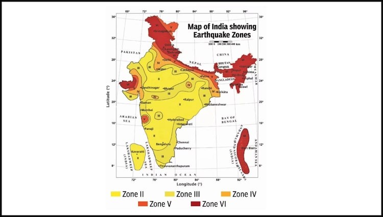
States Now in Highest-Risk Zone VI
The revised seismic map identifies the entire Himalayan belt as India’s most dangerous stretch.
Zone VI — Highest Earthquake Hazard
Jammu & Kashmir
Ladakh
Himachal Pradesh
Uttarakhand
Sikkim
Arunachal Pradesh
Key border regions of Uttar Pradesh and northern West Bengal
Highly populated cities near the Himalayan foothills also face increased vulnerability due to amplified ground shaking.
Why This Matters
India’s northern belt is one of the world’s most densely populated seismic zones. With the new map, the government aims to push states toward proactive disaster-proof planning—ensuring safer homes, stronger infrastructure, and better emergency response systems.